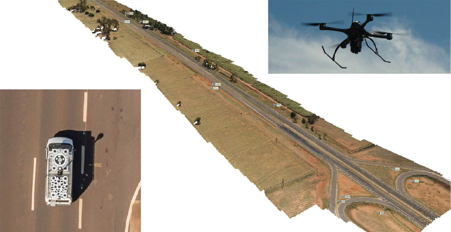
CHC Navigation introduces BB4 UAV and AlphaUni lidar combination
June 23, 2020
Lidar series paired with professional drone provides multi-platform, high-accuracy 3D laser scanning for geospatial and mapping professionals CHC […]
Read More
Researchers from the U.K.’s National Centre for Nuclear Robotics (NCNR) are using Routescene’s UAV lidar technology to map […]
The Library of Congress will celebrate GIS (Geographic Information Science) Day on Nov. 13. GIS Day, which is […]
DT Research has designed a new rugged tablet with 3D imaging that is purpose-built for 3D mapping with […]
Topcon Positioning Group has released its next-generation flight-planning system for its rotary-wing aerial UAV offering. The new Intel Mission […]
Phase One Industrial has expanded its RS and RSM lens offering with three new high performance lenses for […]
Request for Information pursues state-of-the-art technologies for collecting and characterizing 3D mapping and surveying data. DARPA is seeking […]
Kinematic Ground Control point for UAV photogrammetry: A dynamic duo of UAV and mobile van combine to deliver the […]
Follow Us