Golden Software enhances surface mapping package
February 13, 2023
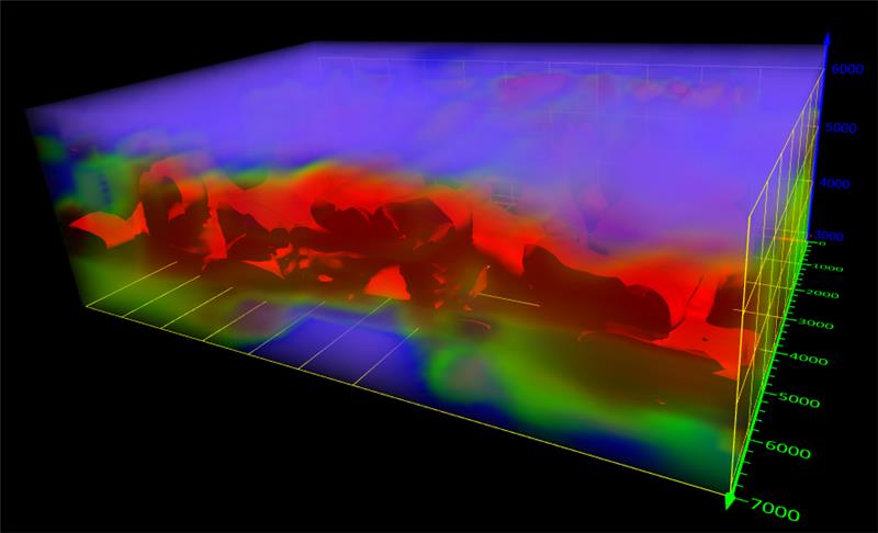
Golden Software’s Surfer package, designed for 3D surface mapping, now provides robust subsurface visualization and modeling functionality.
Read More
Golden Software’s Surfer package, designed for 3D surface mapping, now provides robust subsurface visualization and modeling functionality.

Spirent Federal Systems offers its government customers and contractors a patented “zoned chamber” approach for anechoic-chamber-based CRPA testing.

Hexagon AB has acquired Immersal Oy, an innovator of spatial mapping and visual positioning solutions for producing augmented […]

The European Space Agency (ESA) is issuing a call for ideas to overcome GNSS service gaps in urban […]

Survey and construction software suite MAGNET7 is now available from Topcon, using cloud-based connectivity to streamline workflows through […]
Golden Software has improved visualization and other functionality in the new version of its Surfer gridding, contouring and […]
Highly accurate, UK city-wide 3D models are now available to view and download from Bluesky’s online Mapshop. The geographically […]

UAV technology developer Skyfish has introduced a computing platform for commercial drones that fully automates crucial infrastructure inspection […]


Follow Us