Datumate offers updated imagery software
November 5, 2018
Datumate, a photogrammetry solution and 3D mapping software developer, has released its updated DatuSurvey 5.5 software, which offers […]
Read More
Datumate, a photogrammetry solution and 3D mapping software developer, has released its updated DatuSurvey 5.5 software, which offers […]
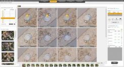
SimActive has updated its Correlator3D end-to-end photogrammetry software to include tools for users to generate precise statistics on […]

In the not-too-distant future, the following scenario may take place. A corporation owns an improved property in a […]
The ZEB-REVO RT is the next generation of the ZEB-REVO, GeoSLAM’s lightweight handheld laser scanner that allows the […]
Hexagon AB has acquired Luciad, a Belgian-based software company specializing in the visualization and analysis of real-time geospatial information. […]

Trimble Earthworks for Excavators and Earthworks for Dozers brings integrated 3D aftermarket excavator automatics capability to machine control. […]
Fugro is enhancing its mapping services with the introduction of an integrated software package that creates realistic, yet […]
Trimble is offering Trimble Earthworks for Excavators and Earthworks for Dozers. Trimble Earthworks is transforming machine control with integrated 3D […]


Follow Us