Orbital Witness wins Airbus’ Global Earth Observation Challenge
October 23, 2017
Airbus has named Orbital Witness the winner of its Global Earth Observation Challenge. Orbital Witness will receive a […]
Read More

Airbus has named Orbital Witness the winner of its Global Earth Observation Challenge. Orbital Witness will receive a […]

It’s been a couple of months since we ran an update on unmanned aircraft, so there are lots […]

Farmstar, a service of Airbus Defence and Space and ARVALIS – Institut du végétal for precision farming based […]

The Business section from the June 2015 issue. Download the PDF. Includes: Hemisphere GNSS Releases Next-Generation GNSS RTK Engine […]

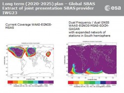
Aircraft navigation and safety will benefit from enhanced, reliable satellite navigation signals on a seamless basis across much of the world in the 2020–2025 timeframe.

Esri has added a pair of new maps to its Nepal Earthquake Maps gallery. Nepal Earthquake Swipe Map […]

Esri has added a pair of new maps to its Nepal Earthquake Maps gallery. Nepal Earthquake Swipe Map […]
Follow Us