NV5 to deploy Hexagon’s Leica CoastalMapper bathymetric lidar system
October 14, 2025
NV5 has become the first geospatial company to acquire and deploy Hexagon’s Leica CoastalMapper.
Read More
NV5 has become the first geospatial company to acquire and deploy Hexagon’s Leica CoastalMapper.
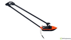
SatLab has introduced the HydroBoat 1200MB, a compact USV engineered for 3D hydrographic surveying in inland and nearshore waters.
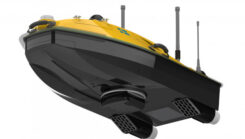
Hydro-Tech ha unveiled the MS400C, a fully integrated multibeam echosounder designed for uncrewed surface vessels.
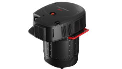
Leica Geosystems, part of Hexagon, has introduced the Leica CoastalMapper, an airborne bathymetric lidar system.

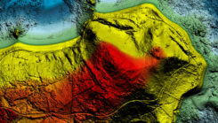
Nearly three quarters of Earth’s surface is covered by water, yet only about a quarter of that surface has been mapped in detail using modern high-resolution technology. The increasing population in coastal regions and rising sea levels due to climate change have heightened the importance of observing coastal transformations, erosion and other marine alterations.
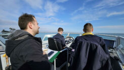
The Royal Navy has successfully tested a new quantum sensing technology designed for underwater detection.
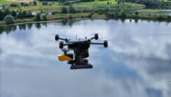
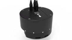
Xer Technologies and YellowScan have partnered to integrate the YellowScan Navigator bathymetric system into Xer Technologies’ UAVs.


Follow Us