Bringing 3D perception beyond autonomous vehicles
April 4, 2022
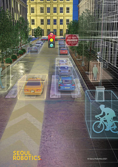
Predictions for the next big industries in lidar By HanBin Lee CEO, Seoul Robotics Lidar sensors that used […]
Read More
Predictions for the next big industries in lidar By HanBin Lee CEO, Seoul Robotics Lidar sensors that used […]

Aerial imagery business Nearmap has launched its new 3D product to streamline the way industries such as urban planning, architecture, construction, […]
GIS is growing in importance to urban development, whether for environmental impact studies, geofencing or building information modeling (BIM). Sharing GIS data with developers is critical to a coordinated approach to smart city growth.

Waze Live Alerts on traffic and infrastructure now available in ArcGIS Marketplace. Waze live alert data will now […]

Bentley Systems’ Year in Infrastructure 2018 Conference will be held Oct. 15-18 in London at the Hilton London Metropole. […]
OnTerra Systems has introduced a new version of its MapSavvy aerial imagery service and a corresponding new website, www.MapSavvy.com. MapSavvy […]
Agency9 has released free global 3D terrain and buildings in CityPlanner, its cloud solution for collaborative urban planning on […]
Brandon Jarratt took GIS professionals behind the scenes of animated city creation at the Esri User Conference, being […]


Follow Us