GPS Reflections Group Honored with Water Prize
November 12, 2014
The GPS Reflections Group of University of Colorado-Boulder has been awarded the prestigious Prince Sultan Bin Abdulaziz International Creativity Prize […]
Read More
The GPS Reflections Group of University of Colorado-Boulder has been awarded the prestigious Prince Sultan Bin Abdulaziz International Creativity Prize […]
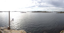
New Tide Gauge Uses GNSS to Measure Sea-Level Change A new way of measuring and monitoring sea level […]
I’m stepping in just for this month as a self-invited guest columnist, giving a brief look at the […]
A new way of measuring sea level using satellite navigation system signals, for instance GPS, has been implemented by scientists at Chalmers University of Technology in Sweden. Sea level and its variation can easily be monitored using existing coastal GPS stations.
Esri announced that the Strauss Center’s Climate Change and African Political Stability (CCAPS) program has implemented Esri technology to view how climate change impacts vulnerable populations in Africa. CCAPS created the dynamic mapping tool in partnership with AidData for use by researchers, policy makers, journalists, and citizens.
How Ionospheric Observations Might Improve the Global Warning System
Recent investigations have demonstrated that GPS might be an effective tool for improving the tsumani early-warning system through rapid determination of earthquake magnitude using data from GPS networks. A less obvious approach is to use the GPS data to look for the tsunami signature in the ionosphere.
Follow Us