March 1, 2023 New feature in OPUS Projects: Using RTN vectors to support 2022 Transformation tool By David B. Zilkoski
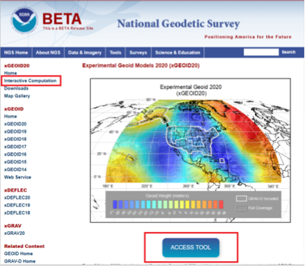
February 3, 2021 NGS releases annual experimental geoid models and gravity interpolation tools By David B. Zilkoski
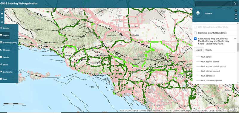
December 2, 2020 ArcGIS web app incorporates datasets, NGS data layers for surveyors By David B. Zilkoski
September 14, 2020 The expanded role of positioning through advancements in GNSS By David B. Zilkoski
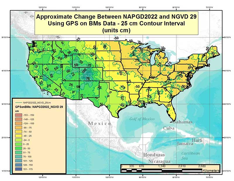
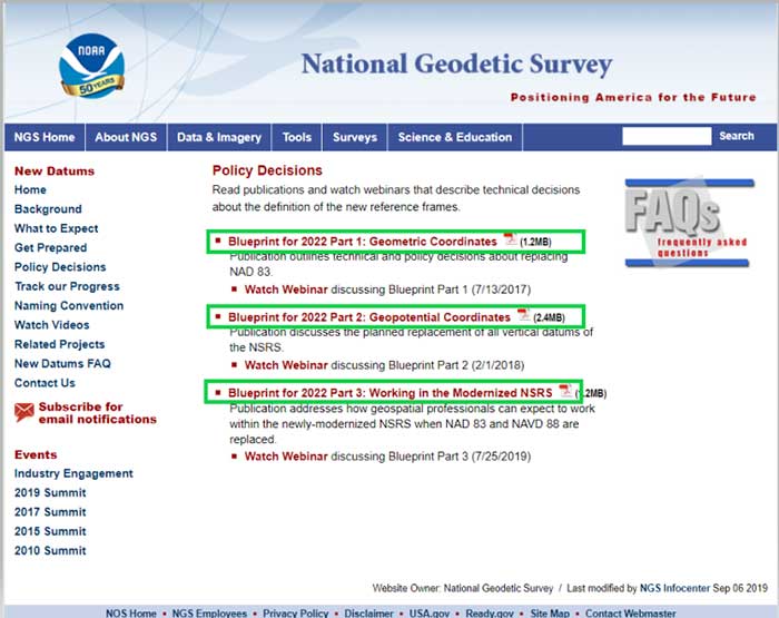
August 5, 2020 NGS releases modernized National Spatial Reference System updates By David B. Zilkoski
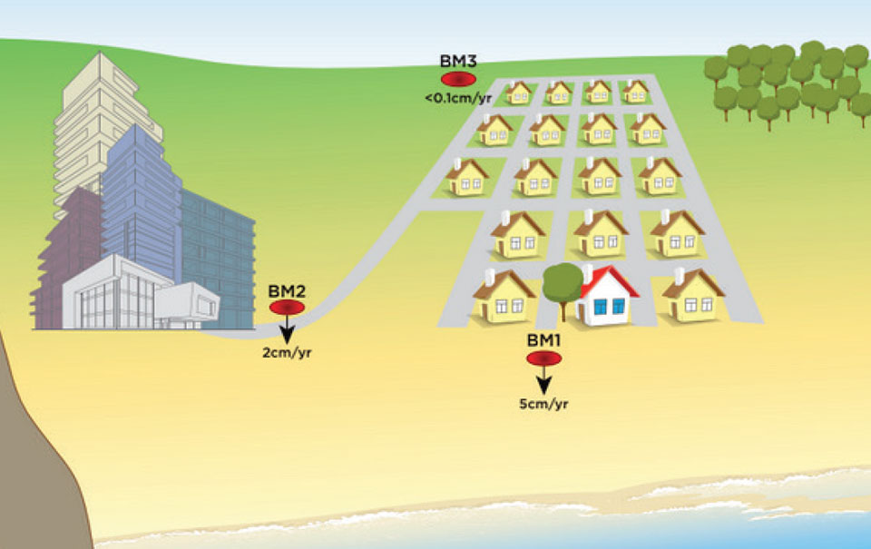
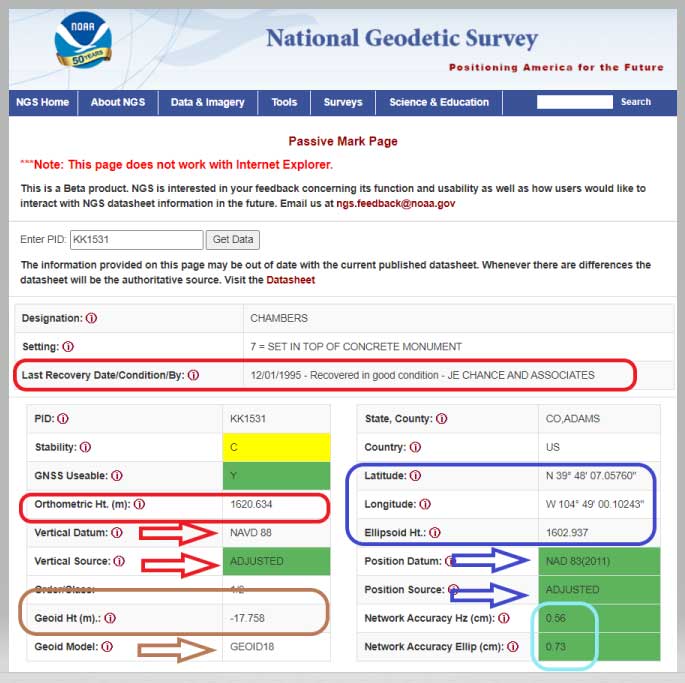
June 3, 2020 Why users will need to perform GNSS occupations as part of a leveling project after 2022 By David B. Zilkoski
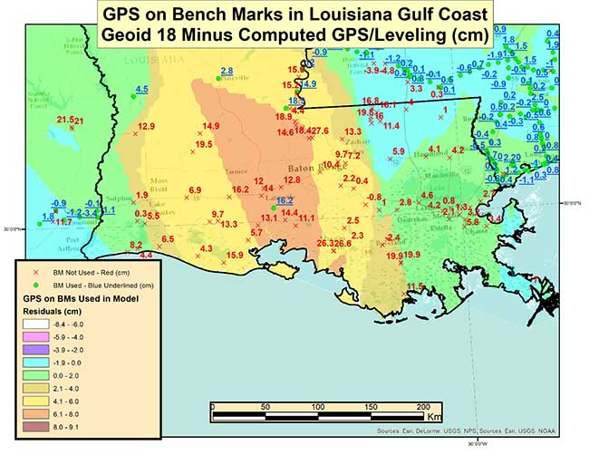
April 1, 2020 The differences between published Geoid18 and Geoid12B values in Southern Louisiana By David B. Zilkoski