
GIS technology plays crucial role in wildfire management and response
February 7, 2025
During times of emergency, geographic information systems (GIS) specialists come together to create real-time mapping tools.
Read More
During times of emergency, geographic information systems (GIS) specialists come together to create real-time mapping tools.
Applanix, a Trimble Company, and the National Oceanic and Atmospheric Administration (NOAA) have collaborated to provide critical information […]
Dewberry, a privately held professional services firm, has been selected as a consultant to Civis Analytics to perform […]

GPS World held a webinar May 21 on new unmanned aircraft initiatives, led by a panel of experts. I also participated, to provide insight into recent UAS industry. More than 300 people attended. We received numerous questions on this hot topic, but in an hour-long webinar, we didn’t have time to provide answers. This month, I tackle those questions, which explore interesting new applications and regulations governing operations for this fast-moving area of technology.

The increased use of Geographic Information Systems (GIS) in disaster management has resulted in the growth of the […]
An exercise in planning for months proves timely in light of Hurricane Sandy By Art Kalinski I was […]
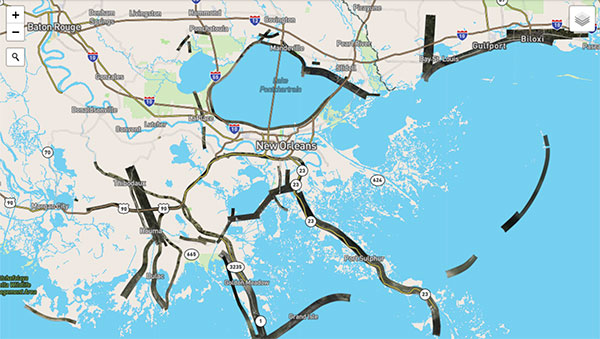
Note to Readers: The CoreLogic storm-surge analysis provided below was developed based on the projected path of […]
Esri announced a strategic alliance with Microsoft to assist public and private agencies and communities around the world during disasters. Microsoft will display Esri public information maps on its cloud-based Disaster Response Incident Portal, as well as point citizens to the maps via its online outlets, such as MSN and Bing.


Follow Us