GIS technology plays crucial role in wildfire management and response
February 7, 2025
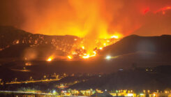
During times of emergency, geographic information systems (GIS) specialists come together to create real-time mapping tools.
Read More
During times of emergency, geographic information systems (GIS) specialists come together to create real-time mapping tools.

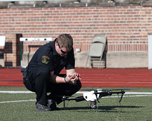
Sikorsky and Rain demonstrated an autonomous Black Hawk helicopter’s capabilities in wildfire suppression.
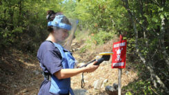
Trimble has expanded support for The HALO Trust, the world’s largest humanitarian landmine-clearance nonprofit organization.

Thales Alenia Space, along with Viettel and MKE, have been selected by Vinamarine to provide Vietnam with a MEOLUT Next ground station.

The catastrophic earthquake that struck Turkiye and northern Syria on Feb. 6, killing more than 50,000 people, has highlighted the need for improved methods to monitor surface changes.
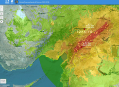
UNOSAT announced via Twitter that it had activated emergency mapping services of Turkey and northern Syria after the magnitude 7.8 earthquake hit.
The U.S. Department of Transportation’s Federal Aviation Administration (FAA) has awarded $2.7 million to support research on how […]
![Image: NAPSG [https://www.napsgfoundation.org/]](https://stage.gpsworld.com/wp-content/uploads/2020/11/NAPSG-webpage-2.jpg)
Tenacity of spirit is one of the great virtues. Supporters of geospatial technology have often had to endure […]


Follow Us