Esri provides mapping software for organizations fighting COVID-19
March 20, 2020
Communities in need of resources can access location intelligence technology at no cost with six-month trial Location intelligence […]
Read More
Communities in need of resources can access location intelligence technology at no cost with six-month trial Location intelligence […]
Polaris Wireless is partnering with Mark43 to integrate 3D location technology into computer-aided dispatch systems for public safety […]
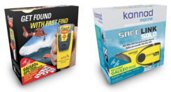
Orolia’s McMurdo FastFind 220 and Kannad SafeLink Solo personal location beacons (PLB) now operate with the Galileo GNSS […]
High-resolution airborne lidar data to be acquired over 34,000 square miles for disaster response and recovery. Under an […]
Reflecting the dramatic changes and advances that have taken place in the applications of positioning technology over the […]
A team of five volunteers armed with drones, advanced sensor systems and GIS technologies joined the response effort […]
The Open Geospatial Consortium (OGC) is hosting the second Disasters Concept Development Study Workshop July 24-25 at the […]
At least 65 people have been rescued by drones in the last year, according to a new report […]
Follow Us