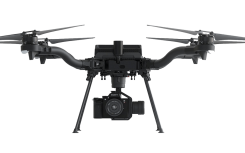
Esri Site Scan, Auterion drone help meet regulations
November 2, 2020
Esri is offering two major capabilities in Site Scan for ArcGIS that will enable governments and critical infrastructure […]
Read More

Esri is offering two major capabilities in Site Scan for ArcGIS that will enable governments and critical infrastructure […]

GMV will take charge of the command and control and C4ISR interoperability system under the Integrated Modular Unmanned […]

Drone technology takes center stage in a new European report on the continent’s air traffic management. U-Space: Supporting […]

GMV has been awarded the SUGUS project (Solution for E-GNSS U Space Service), which aims to speed the […]

Aireon and EUROCONTROL have signed a 10-year agreement to integrate space-based ADS-B data into their air traffic management […]

A key feature of a new high-accuracy GNSS correction serviceThe design, construction, operation and performance of the first safety-critical, high-accuracy augmentation service for autonomous applications.
Sapcorda Services GmbH has released its SAPA (Safe And Precise Augmentation) Premium GNSS positioning service. The SAPA service […]

No One Is in Charge Guest column by Dana Goward Europe’s scattered monitoring of GNSS signals found almost […]
Follow Us