Skip to content

TAG: Frontier Precision

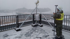
The surveyor used Mars Pro Laser RTK and Survey Master software to measure the reference points within coverage areas of surveillance cameras. (Photo: Geosurf Corporation)

From grading to mapping: Surveyors tie dirt to data

January 13, 2025

1
Photo:

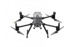
Frontier Precision announces upgraded UAV platform

May 27, 2023

This article is tagged with , , , and posted in Latest News, UAV/UGV
2
logo FP techXpo

Frontier Precision launches virtual User Conference for 2021

March 5, 2021

3

Volcanic GIS: Mapping and imaging the Kilauea eruption

August 16, 2018

4