Blue Marble Geographics updates Global Mapper GIS software
February 27, 2019
Blue Marble Geographics has released Global Mapper v.20.1, the latest version of its GIS software. According to the […]
Read More
Blue Marble Geographics has released Global Mapper v.20.1, the latest version of its GIS software. According to the […]

Upgrade to MAGNET Collage Web includes with new deliverable options. Topcon Positioning Group has upgraded its MAGNET Collage Web, […]
Location content provider Nearmap has partnered with the city of Durham, North Carolina, to help it manage infrastructure […]

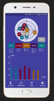
Global GNSS, a subsidiary of Polosoft Technologies, has launched a new mobile application named GNSS Surveyor, which is […]
United States’ election directors are interested, but “less than halfway,” in terms of implementing GIS to strengthen the […]
Includes first draft of best practices for implementing GIS in elections. The National States Geographic Information Council (NSGIC) […]
Version 20 of the Global Mapper Software Development Kit (SDK) is now available, along with the accompanying Lidar […]
The just-passed Geospatial Data Act (GDA) is a unifying federal geospatial policy decades in the making, and is set to change the country, and the world.
Follow Us