Analysis of geomagnetic storm shows need for mitigation during ionospheric disruptions
July 8, 2025
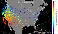
During the geomagnetic storm that took place May 10–11, 2024, GPS users reported significant positioning errors and outages.
Read More
During the geomagnetic storm that took place May 10–11, 2024, GPS users reported significant positioning errors and outages.

We discussed Satellite Time and Location (STL) services and complementary PNT with Michael O’Connor, CEO at Satelles.
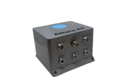
Oceanographic & Geophysical Instruments (OGI) has selected iXblue’s Atlans INS to provide robust and uninterrupted data georeferencing to its […]


Follow Us