Saildrone, NOAA initiate tracking of seasonal hurricane activity
August 12, 2024
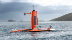
Saildrone and NOAA are sailing a fleet of uncrewed surface vehicles (USVs) into hurricanes to better understand how these storms develop, track and intensify.
Read More
Saildrone and NOAA are sailing a fleet of uncrewed surface vehicles (USVs) into hurricanes to better understand how these storms develop, track and intensify.
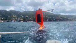
As Hurricane Beryl moved across the Caribbean, NOAA has partnered with Saildrone to deploy seven hurricane-tracking saildrones in strategic locations.
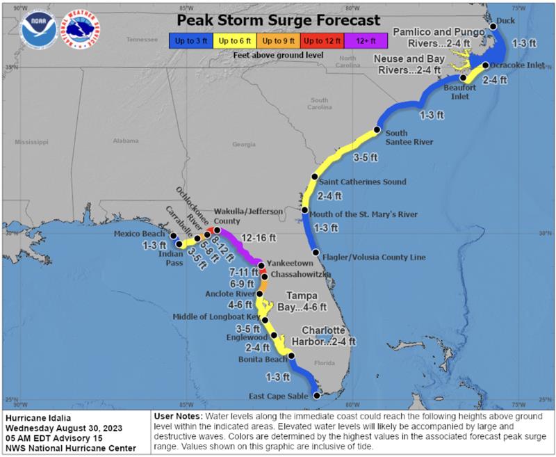
According to the U.S. NHC, Hurricane Idalia made landfall along the Gulf Coast of Florida around 7:45 a.m. EDT on August 30 as a Category 3 hurricane.

“Seen & Heard” is a monthly feature of GPS World magazine, traveling the world to capture interesting and unusual news stories involving the GNSS/PNT industry.
Since Nov. 26, NASA’s Cyclone Global Navigation Satellite System (CYGNSS) team has not been able to make contact […]
The surveying profession has experienced a plethora of advancing technology over the past two decades and it does not look like there will be a slowdown any time soon.

Whether you are on the helping end of a disaster aiding in rescue and recovery, or on the receiving end being aided, GIS is supercharging the rescue efforts.
Hurricane Harvey is hitting Texas with wind speeds of at least 111 mph. Widespread flooding is a risk for […]


Follow Us