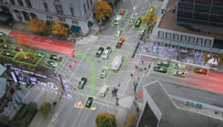
Seen & Heard: Self-driving cars get smarter, Antarctic Peninsula turns green and more
December 27, 2024
“Seen & Heard” is a monthly feature of GPS World magazine, traveling the world to capture interesting and […]
Read More
“Seen & Heard” is a monthly feature of GPS World magazine, traveling the world to capture interesting and […]

Not to harp on an event that’s already passed out of the headlines and national coverage, but Hurricane […]
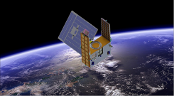
A new GNSS radio-occultation (RO) satellite is now in orbit. The GNOMES-3 — GNSS Navigation and Occultation Measurement […]
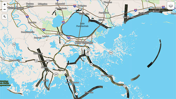
Applanix, a Trimble Company, and the National Oceanic and Atmospheric Administration (NOAA) have collaborated to provide critical information […]
Raytheon Company and the National Oceanic and Atmospheric Administration received Aviation Week magazine’s Laureate Award for using the […]
Free and rapid imagery was provided through the USGS Hazard Data Distribution System. The calls for assistance started […]

Esri is providing a continuously updated hurricane map that shows the projected paths, storm surge, weather warnings and precipitation […]
CoreLogic has introduced wind verification technology that will improve the accuracy and timing of insurance claims related to severe […]


Follow Us