Spectracom Teams with Geodetics For Rugged PNT Equipment
July 23, 2013
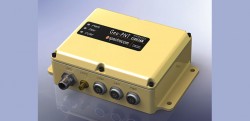
Spectracom announced today a strategic partnership with Geodetics Incorporated of San Diego, California. The partnership includes a variety […]
Read More
Spectracom announced today a strategic partnership with Geodetics Incorporated of San Diego, California. The partnership includes a variety […]

When a team of firefighters, first responders, or soldiers operates inside a building, in urban canyons, underground, in foliage, or under the forest canopy, the GPS-denied environment presents unique navigation challenges. An enhanced personal inertial navigation system (ePINS), based on a strapdown navigation solution using a mid-grade IMU and wavelet-based motion-classification algorithms, can track positions with errors of less than 2 percent of distance traveled in both indoor and outdoor environments.

Trimble has introduced the AP20-C, the latest addition to its AP Series of embedded GNSS-Inertial OEM boards plus Inertial Measurement Unit (IMU). Using a compact, custom-built IMU based on commercial Micro Electromechanical Machined (MEMS) inertial sensors, the AP20-C enables system integrators to achieve high-rate position and orientation measurements with exceptional accuracy, Trimble said.
Advanced Navigation, a leading developer of 3D navigation technologies, has launched its Spatial product series, featuring NVS Technologies AG’s NV08C-MCM high-performance multiple GNSS-constellation receiver. The Spatial is a ruggedized miniature GNSS/INS & AHRS system that provides accurate position, velocity, acceleration and orientation under demanding conditions. It combines temperature calibrated accelerometers, gyroscopes, magnetometers and a pressure sensor with an advanced GNSS receiver. These are coupled in a sophisticated fusion algorithm to deliver accurate and reliable navigation and orientation, Advanced Navigation said.
A new hardware assessment tool automates testing and mission replay, managing military GPS receiver input and output data, with an operational implementation and with a better control of initialization conditions, especially direct P(Y) acquisition. The test bench drives a GPS/Galileo simulator, a digital jammer, and software programs for visibility computation based on terrain modeling, and for multipath generation on 3D renderings.


Follow Us