February 17, 2026 Evolution: Machine learning for station specific Ionosphere prediction in GNSS positioning By Sunil Bisnath and Dr. Taiwo Osanyin
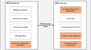
October 17, 2025 Adaptive model shields real-time positioning from ionospheric chaos By Tracy Cozzens
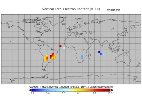
July 14, 2025 Nowcasting the ionosphere: Evaluating GloTEC for real-time GNSS corrections By Sean Gorman