December 17, 2020 Leica Geosystems launches one app for terrestrial laser scanning portfolio By Allison Kral
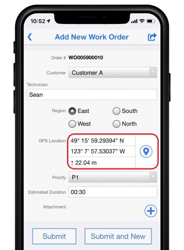
October 24, 2019 Flowfinity and Leica Geosystems streamline high-precision GNSS data collection workflows By Tracy Cozzens
April 30, 2018 Leica smart antenna features tilt compensation, magnetic field resistance By Tracy Cozzens