October 26, 2015 Leica Geosystems, NCTech Streamline Workflows, Improve Productivity By GPS World Staff
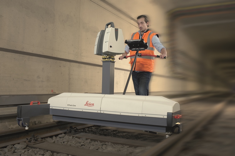
October 14, 2015 SiTrack:One by Leica Geosystems Makes 3D Point Clouds without GNSS By GPS World Staff