Latest YellowScan lidar system designed for UAV surveys
April 3, 2018
YellowScan has launched a new lidar system, the Surveyor Ultra. It integrates the Velodyne VLP-32C scanner and the […]
Read More

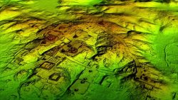
Lidar and UAV technology has revealed hundreds of previously unknown Mayan ruins in the Guatemalan rainforest. In what is […]

Lidar and UAV technology has revealed hundreds of previously unknown Mayan ruins in the Guatemalan rainforest. In what is […]


Leigh Stearns, a geologist with the University of Kansas, is working with a Riegl VZ-6000 ultra long range […]

The Think 3D Stormbee multicopter integrated with Trimble’s AP15 provides efficiency, accuracy and performance for lidar surveys from unmanned vehicles. Historically, […]
Follow Us