Nearmap imagery wins business for solar installer
March 18, 2019
High-resolution aerial maps from NearMap are helping Auric Solar, a residential and commercial solar power provider, accelerate its […]
Read More

High-resolution aerial maps from NearMap are helping Auric Solar, a residential and commercial solar power provider, accelerate its […]

By Daniela E. Sánchez, Harvey C. Gómez and Thomas Pany, Institute of Space Technology and Space Applications (ISTA) […]

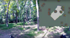
Researchers at the Massachusetts Institute of Technology (MIT) presented a project at the International Symposium on Experimental Robotics […]

Lidar USA has integrated Z+F scanners for mobile mapping into its product line. According to the company, the […]
The Advanced Rapid Imaging and Analysis (ARIA) team at NASA’s Jet Propulsion Laboratory in Pasadena has produced a […]
Follow Us