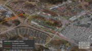
Skip to content

TAG: Maxar

Photo: Vantor

Maxar Intelligence rebrands to Vantor, unveils AI-powered platform

October 1, 2025

This article is tagged with , , , and posted in Defense, Latest News, Mapping
Vision-based positioning software loaded directly onto the drone that enables the platform to determine its aerial position with demonstrated absolute accuracy of

Maxar helps accelerate the resilience of Taiwan’s UAV industry against GPS interference

September 19, 2025

This article is tagged with , , , and posted in Complementary PNT, Latest News, UAS/UAV, UAV/UGV
Photo: seregalsv / iStock / Getty Images Plus / Getty Images

Seen & Heard: UAVs to the rescue, fire strikes in Chile

March 29, 2024

This article is tagged with , , and posted in From the Magazine, Latest News, Mapping, UAV/UGV
Image: Maxar Technologies

Massive earthquake shifts land in Japan

January 9, 2024

This article is tagged with , and posted in Featured Stories, Latest News, Mapping, UAV/UGV
The U.S. Air Force’s Lockheed Martin-built next generation GPS III satellite on orbit. Rendering portrays GPS III Space Vehicles (SVs) 01-10. (Artist's Rendering: Lockheed Martin)

Russia could target GPS, warns NRO director

February 24, 2022

This article is tagged with , , , , and posted in GNSS, Latest News
The Gripen E jet fighter built by Saab. (Photo: Saab)

Maxar 3D data integrated into Swedish fighter jet for GPS-denied navigation

October 18, 2021

This article is tagged with , , and posted in Defense, Featured Stories, Latest News
Closeup of fires at Honesuckle Point south of Eden. (9atellite image ©2020 Maxar Technologies)

Visualizing the Australian bushfires through satellites and maps

January 13, 2020