
UAV images show inspection action
October 16, 2018
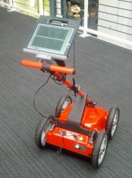
The UAV inspection industry continues to grow, as evidenced by these photos of actual end-user application. Unmanned systems […]
Read More
The UAV inspection industry continues to grow, as evidenced by these photos of actual end-user application. Unmanned systems […]
If you blink, you might miss something! The examples here represent only a fraction of this booming field, […]
GEO Business, the United Kingdom’s largest geospatial exhibition and conference, has announced that registration is now open. The […]
The Kenyan government will be using SimActive’s Correlator3D to map mining activities. The software will be used to generate orthomosaics, […]

Locata Corporation and Hexagon Mining have partnered to bring Locata technology to mines. The JPS (Jigsaw Positioning System) is […]

Geoscience Australia, an agency of the Commonwealth of Australia, and Lockheed Martin have entered into a collaborative research […]
As part of an ongoing commitment to transform the way mines manage their business, Caterpillar Inc. and Trimble are […]
Eos Systems Inc. has introduced new photogrammetry software optimized specifically for photographs taken with drones or unmanned aerial […]


Follow Us