
NGS’s first alpha products for the modernized NSRS
September 6, 2023
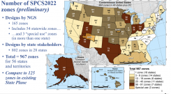
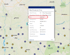
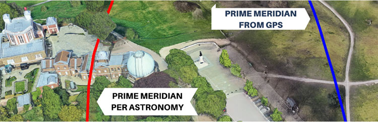
GPS World contributor, David Zilkoski, explores the National Geodetic Survey’s (NGS) new Alpha site, designed to enable users to preview preliminary NSRS products and services.
Read More


Follow Us