Building a better world: Esri UC announces plenary speakers
June 28, 2021
The 2021 Esri User Conference — taking place virtually July 12-15 — has announced its plenary session theme […]
Read More
The 2021 Esri User Conference — taking place virtually July 12-15 — has announced its plenary session theme […]
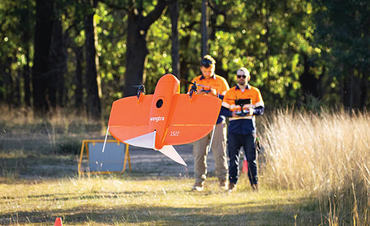
The worlds of UAVs, lidar and surveying overlap, with UAV-based lidar able to shed light on places that […]
The National Geographic Society, working with partners at Google and World Resources Institute, is building a living map […]

Detailed 3D maps of the iconic and historic Notre Dame Cathedral in Paris hold out hope for accurate […]

Lidar and UAV technology has revealed hundreds of previously unknown Mayan ruins in the Guatemalan rainforest. In what is […]
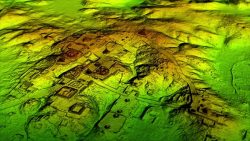
Lidar and UAV technology has revealed hundreds of previously unknown Mayan ruins in the Guatemalan rainforest. In what is […]
National Geographic Maps has joined with Avenza Systems to offer a new channel to access its map content. […]


Follow Us