Solar Storm may impact GPS
June 1, 2025
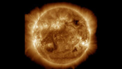
A geomagnetic storm expected today and tomorrow has been upgraded to G4 (severe) by the National Oceanic and Atmospheric Administration (NOAA).
Read More
A geomagnetic storm expected today and tomorrow has been upgraded to G4 (severe) by the National Oceanic and Atmospheric Administration (NOAA).
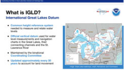
David Zilkoski provides updates about the vertical datums that the National Oceanic and Atmospheric Administration (NOAA) is working on.
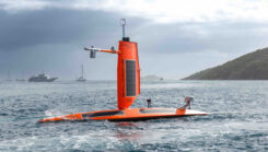
Saildrone and NOAA are sailing a fleet of uncrewed surface vehicles (USVs) into hurricanes to better understand how these storms develop, track and intensify.
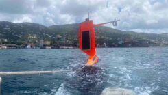
As Hurricane Beryl moved across the Caribbean, NOAA has partnered with Saildrone to deploy seven hurricane-tracking saildrones in strategic locations.

The National Oceanic and Atmospheric Administration (NOAA) has entered into a three-year Cooperative Research and Development Agreement (CRADA) with Verizon Frontline to refine the use of uncrewed aircraft systems (UAS) for assessing storm damage.
Earth is experiencing a severe solar storm causing concern for those responsible for power grids, communication systems and satellites. NOAA has reported measurable effects and impacts from the geomagnetic storm that has been visible as aurora across vast swathes of the Northern Hemisphere.
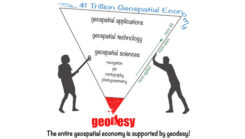
Michigan State University (MSU) has been awarded an NOAA FY 23 Geospatial Modeling Competition Award. MSU will create geodesy curriculums to help address the geodesy crisis and more.
NGS awarded $4 million in grant funding to four institutions for projects that will research emerging problems in the field of geodesy, develop tools and models to advance the modernization of the National Spatial Reference System, and help address a nationwide deficiency of geodesists.


Follow Us