NV5 Geospatial maps North American shorelines and riverine environments
April 4, 2023
NV5 Geospatial has mapped more than 26 million acres of North America’s shoreline and riverine environments across more than 200 projects.
Read More
NV5 Geospatial has mapped more than 26 million acres of North America’s shoreline and riverine environments across more than 200 projects.

“Seen & Heard” is a monthly feature of GPS World magazine, traveling the world to capture interesting and […]
The COSMIC-1 program ended on May 1, when the last of six tiny satellites were decommissioned. The satellites […]
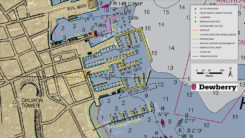
Dewberry has been selected by the National Oceanic and Atmospheric Administration (NOAA) for the agency’s Shoreline Mapping Services contract. […]
Raytheon Company and the National Oceanic and Atmospheric Administration received Aviation Week magazine’s Laureate Award for using the […]

Here in the U.S., this past summer saw an unprecedented number of emergency situations. Hurricanes blasted Texas, Florida, […]

Aircraft to Provide Wildfire Measurements in Support of NOAA Fire Weather Forecasting The U.S. National Oceanic and Atmospheric […]

The U.S. National Oceanic and Atmospheric Administration (NOAA) is seeking new members for its Hydrographic Services Review Panel, […]


Follow Us