Skip to content

TAG: Nearmap

DroneSentry-C2 with Nearmap location data. (Screenshot: DroneShield)

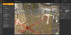
Nearmap and DroneShield join forces to protect against unmanned aerial threats

April 8, 2022

1
Photo: CHC Nav

Building with precision: Surveying for architecture, engineering & construction

February 28, 2022

2
Penny Diamantakiou

Nearmap appoints new chief financial officer

February 1, 2022

This article is tagged with , , and posted in Latest News, Mapping
3
A Salt Lake City neighborhood. (Photo: Nearmap)

Nearmap expands, capturing aerial imagery of 80% of US population

September 14, 2021

4

Indiana city increases citizen engagement with user-friendly GIS program

August 25, 2021

5
Photo: Nearmap

Seen & Heard: Ingenuity’s PNT hiccup, Avengers assemble!

June 28, 2021

6
Photo: sassy1902/E+/Getty Images

Nearmap partners with GTG to help local governments

April 23, 2021

7

AI and intuitive cameras pave way for future of aerial imaging

September 2, 2020

8