Landviewer’s new change detection tool runs in a browser
June 19, 2019
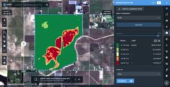
A major use of remote sensing data is to compare images of an area taken at different times […]
Read More
A major use of remote sensing data is to compare images of an area taken at different times […]


Follow Us