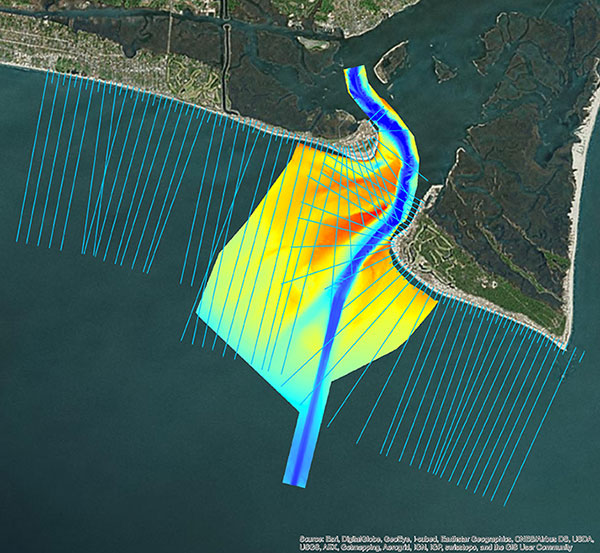
TAG: NV5 Geospatial

The women putting NV5 Geospatial GIS on the map

May 19, 2021

Multi-beam bathymetry and topo/bathy beach profiles of the Cape Fear River Inlet (USACE Wilmington). (Image: NV5 Geospatial)

NV5 Geospatial acquires Geodynamics to expand marine survey offerings

May 18, 2021

Photo: Fixar

Launchpad: GPS chips, drones, mapping software

May 13, 2021

NV5 Geospatial releases cloud-based geospatial data management platform

February 12, 2021