
LandWorks Adds Linear Project Routing to Online Property Mapping Service
September 15, 2014
LandWorks Inc., a developer of land-management solutions, has added linear project mapping capabilities to its online Web AutoMapper […]
Read More
LandWorks Inc., a developer of land-management solutions, has added linear project mapping capabilities to its online Web AutoMapper […]
CartoPac International Inc. has announced a major new release of the CartoPac Mobile Platform. CartoPac 5.0 extends the mobile […]
On August 29, OmniEarth completed its acquisition of IRISmaps, Inc., in a stock-for-stock transaction. IRIS provides customized, cloud-based solutions that integrate […]
PeopleNet, a Trimble company and provider of fleet mobility technology that optimizes performance and decision-making management, has […]
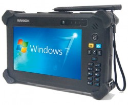
The DuraBook T7Q by GammaTech is a fully rugged Windows 7 Professional tablet PC designed to meet the […]
Spatial Energy has signed a partnership agreement with Geoimage, headquartered in Brisbane, Australia. According to Spatial Energy, the […]
Geoforce, Inc. is announcing commercial availability of its GT-1 asset tracking device that can track field equipment in […]
One of the first industrial uses of GPS came in survey and seismic exploration for offshore oil, as evidenced by the cover story of this magazine’s September 1992 issue. A salient passage from that 18-year-old “Quality Control For Differential GPS in Offshore Oil and Gas Exploration” article:
“Users are in danger of being mesmerized by the apparent simplicty of the technology and abandoning quality-control principles . . . . The key to routine operations is rigorous real-time quality control.” Eerily, among the companies acknowledged for support of that article was BP Exploration.


Follow Us