
SimActive integrates software in lidar solution for drones
December 8, 2020
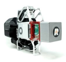
SimActive Inc., a developer of photogrammetry software, has integrated its Correlator3D product into lidar systems for drones developed […]
Read More
SimActive Inc., a developer of photogrammetry software, has integrated its Correlator3D product into lidar systems for drones developed […]

Everywhere we look, data is being collected, reviewed, analyzed and stored. It used to be that data was […]
GeoCue Group has released the True View 615 and True View 620 UAS lidar 3D imaging systems. The […]
U.S. CAD is working with Pointfuse to help shape the future of point cloud processing software. This collaboration […]
SimActive’s Correlator3D software is being used by by Dutch company NEO B.V. to assess solar potential in multiple […]
Verified photomontages for UNESCO World Heritage sites achieves accuracy with Spectra Geospatial SP80 Verified photomontage is an important […]
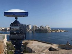
Verified photomontages for UNESCO World Heritage sites achieves accuracy with Spectra Geospatial SP80 Verified photomontage is an important […]

Septentrio’s post-processing kinematic (PPK) software has been upgraded with multi-GNSS and BaseFinder functionality. BaseFinder improves project efficiency by […]


Follow Us