Pointfuse laser scanning software transforms digital construction workflows
September 12, 2019
Pointfuse has released the latest version of its advanced point cloud processing software that converts the millions of […]
Read More
Pointfuse has released the latest version of its advanced point cloud processing software that converts the millions of […]
SimActive Inc., a developer of photogrammetry software, announced that Correlator3D is being used for mapping projects in Brittany, […]
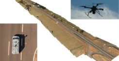
Kinematic Ground Control point for UAV photogrammetry: A dynamic duo of UAV and mobile van combine to deliver the […]
Photogrammetry software Correlator3D was used for a large-scale project by First Base Solutions, announced software developer SimActive Inc. The software […]
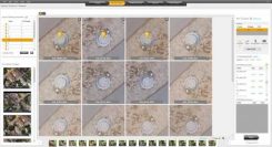
Datumate, a photogrammetry solution and 3D mapping software developer, has released its updated DatuSurvey 5.5 software, which offers […]
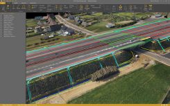
SimActive has updated its Correlator3D end-to-end photogrammetry software to include tools for users to generate precise statistics on […]
The newly released version 6 of the Virtual Surveyor drone surveying software offers a faster, more efficient workflow and […]

Drones and robots complement traditional platforms, delivering insights in unique use cases. Guest column by Mike Fuller Geographic […]


Follow Us