
Laser scan data improves response in active shooter simulation
August 14, 2019
A security technology firm reduced the time needed for public-safety personnel to engage a simulated active shooter by […]
Read More
A security technology firm reduced the time needed for public-safety personnel to engage a simulated active shooter by […]
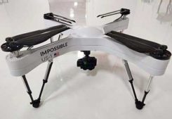
Auterion and Impossible Aerospace are collaborating to bring to market the US-1 UAV, which has a two-hour flight time. Auterion […]
Newly captured aerial maps show before and after images to support cleanup efforts by public safety organizations, utility […]
FAA also warns about drones interfering with public safety. The Federal Aviation Administration (FAA) has announced nine new […]
The Shelby County, Tennessee, Emergency Communications District has implemented Nearmap high-resolution aerial imagery to geocode and plot new […]
According to NextNav, its altitude service delivered floor-level accuracy in 94 percent of test calls in recent blind industry […]
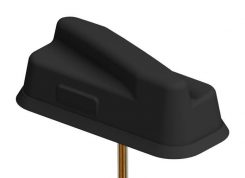
PCTEL Inc. has announced the next generation of its Trooper antenna, the company’s flagship multi-band platform for public safety […]
The Nevada Institute for Autonomous Systems (NIAS) has launched of the Nevada Drone Center of Excellence for Public […]


Follow Us