Lidar reveals lost cities in the Amazon
January 22, 2024
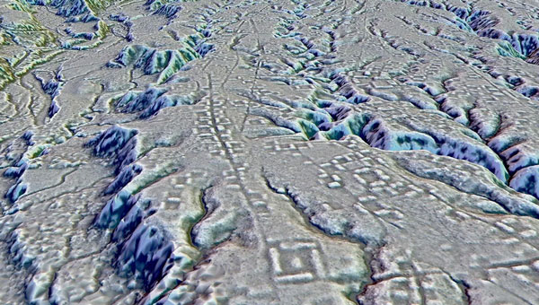
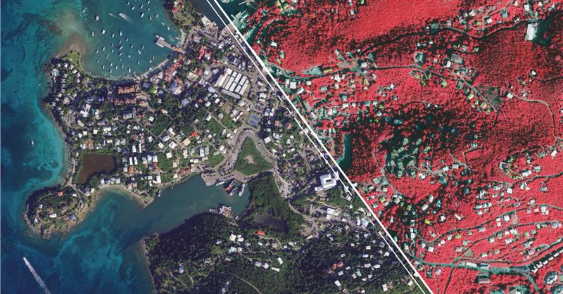
Archeologists have discovered a vast and highly complex system of ancient cities dating back nearly 3,000 years in the Amazon rainforest. Complete with a complex network of farmland and roads, the discovery is the oldest and largest of its kind in the region.
Read More


Follow Us