
Research Roundup: Mitigating GNSS interference
September 3, 2022
GNSS researchers are presenting hundreds of papers at the 2022 Institute of Navigation (ION) GNSS+ conference, taking place […]
Read More
GNSS researchers are presenting hundreds of papers at the 2022 Institute of Navigation (ION) GNSS+ conference, taking place […]
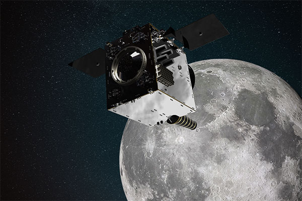
NASA and its international partners are planning a return to our natural satellite. The following three papers — […]

Of the hundreds of papers researchers presented at 2020’s annual Institute of Navigation (ION) GNSS+ conference, which took […]

Using data from GPS receivers and seismographs, three seismologists may have found a way to identify tsunami earthquakes […]

Creating detailed street maps and keeping them updated is an expensive and time-consuming task performed mostly by large […]

Of the 273 papers researchers presented this year at the Institute of Navigation’s annual ION GNSS+ conference, which […]

Soft information for IoT positioning The billions of interconnected devices and sensors embedded in other devices, vehicles and […]
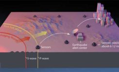
Previous research suggests that not until halfway through a rupture (90 seconds for a magnitude-9 quake) can magnitude be […]


Follow Us