Geospatial imagery shows activity at Iranian nuclear facility
July 7, 2021
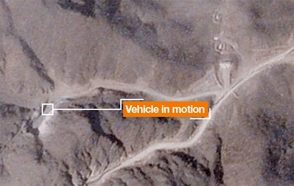
A team with Stanford University’s Center for International Security and Cooperation (CISAC) used BlackSky’s geospatial imagery and burst […]
Read More
A team with Stanford University’s Center for International Security and Cooperation (CISAC) used BlackSky’s geospatial imagery and burst […]

$50K prize purse for solutions to advance computer vision for time-sensitive mapping The National Geospatial-Intelligence Agency (NGA), Johns […]
In recent years, sinkholes have been occurring around the world. A new service offers a sinkhole detection prediction […]
SimActive’s Correlator3D software is being used by by Dutch company NEO B.V. to assess solar potential in multiple […]
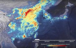
Descartes Labs, a geospatial data analytics company, is using satellite imagery analysis to examine how the coronavirus reduced […]
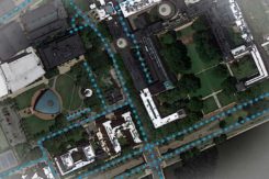
Creating detailed street maps and keeping them updated is an expensive and time-consuming task performed mostly by large […]
The first two Airbus-built Pléiades Neo imaging satellites have started comprehensive environmental testing to ensure they are ready […]
The months-long wildfires raging in Australia have killed at least 25 people. Millions — possibly 1 billion — […]


Follow Us