
Revealing underwater landscapes: Trends in bathymetric surveying
January 31, 2025
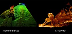
Nearly three quarters of Earth’s surface is covered by water, yet only about a quarter of that surface has been mapped in detail using modern high-resolution technology. The increasing population in coastal regions and rising sea levels due to climate change have heightened the importance of observing coastal transformations, erosion and other marine alterations.
Read More


Follow Us