August 6, 2018 Trimble RTX achieves greater than 2-cm horizontal accuracy, company says By GPS World Staff
April 30, 2018 Leica smart antenna features tilt compensation, magnetic field resistance By Tracy Cozzens
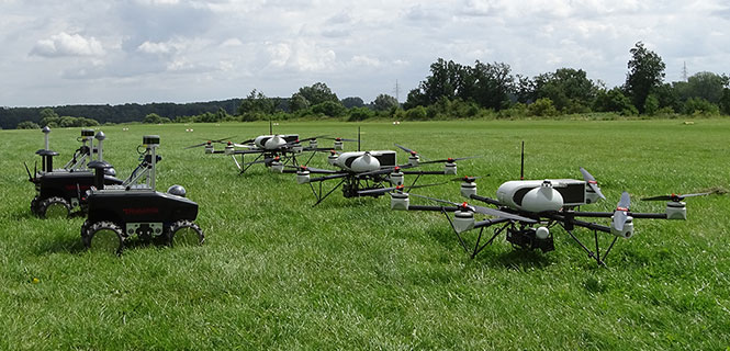
April 9, 2018 Teaming ground and air vehicles for an autonomous multi-sensor survey By Simon Batzdorfer, Markus Bobbe, Martin Becker, and Ulf Bestmann