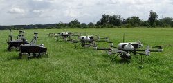
Teaming ground and air vehicles for an autonomous multi-sensor survey
April 9, 2018
By Simon Batzdorfer, Markus Bobbe, Martin Becker and Ulf Bestmann, Technische Universitaet Braunschweig All images courtesy of the […]
Read More

By Simon Batzdorfer, Markus Bobbe, Martin Becker and Ulf Bestmann, Technische Universitaet Braunschweig All images courtesy of the […]

Trimble has debuted the MPS865 marine positioning system multi-frequency and multi-application GNSS receiver. The Trimble MPS865 is a […]

YellowScan has launched a new lidar system, the Surveyor Ultra. It integrates the Velodyne VLP-32C scanner and the […]

Tersus GNSS is now offering its David real-time kinematic (RTK) GNSS receiver with seven new base/rover kits. Tersus […]

Japan-based Aerosense Inc. has commercialized its AEROBO marker solution for drone surveying using the u‑blox NEO‑M8T timing module. […]

The new software release of Survey123 for the ArcGIS mobile application now has Spike, a laser measurement solution […]

SURVEY & MAPPING Mobile surveying app Increases RTCM 3.1 support SuperSurv’s NTRIP solution is being enhanced to adopt […]

Delair, a supplier of drone solutions for commercial industries, has introduced the next-generation of its high-performance DT26X Lidar UAV. […]
© 2025 North Coast Media LLC, All Rights Reserved.

Follow Us