February 6, 2017 New NovAtel firmware for OEM7 offers interference toolkit, RTK Assist By GPS World Staff
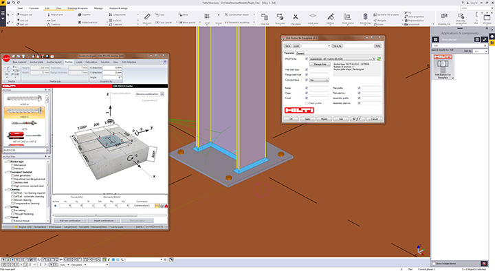
November 8, 2016 Trimble and Hilti deliver integrated solutions for construction professionals By GPS World Staff