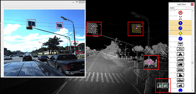
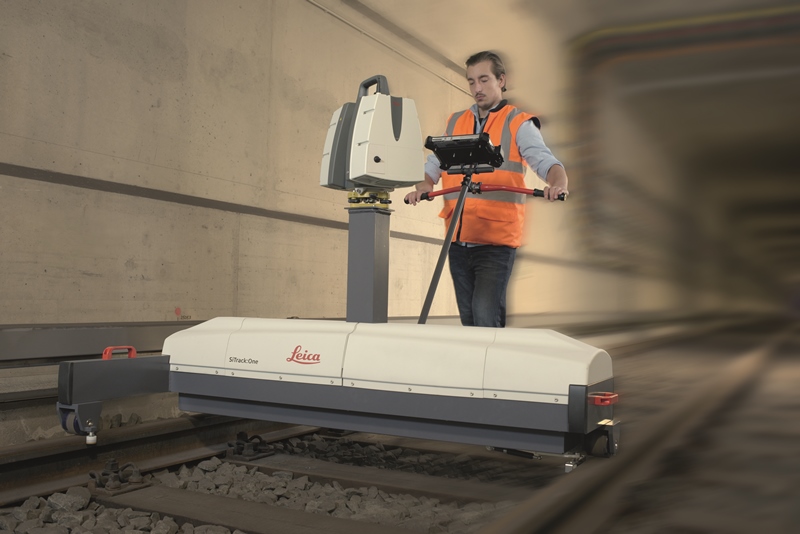
Skip to content

TAG: surveying

Image: GPS World

Data collection of WGS 84 information — or is it?

November 2, 2016

This article is tagged with , , , and posted in Opinions, Survey
Image: GPS World

Eos introduces photogrammetry software for drone photography

October 26, 2016

This article is tagged with , , , , , , and posted in GIS News, GNSS/GPS, UAS/UAV
Hurricane Matthew, which formed Sept. 28 and dissipated Oct. 10, brought torrential rains to the Carolinas, causing widespread flooding. The above is a screenshot from a drone inspection video.

After the storm: Drone flights enable speedy cellular inspections

October 22, 2016

This article is tagged with , , , , , and posted in Featured Stories, Latest News, UAV/UGV
Rory San Miguel (left) and Francis Vierboom, co-founders and CEOs of Propeller Aero, display the new Aeropoints product. (Photo: Propeller Aero)

DJI joins Propeller Aero on turnkey solutions

October 19, 2016

This article is tagged with , , , and posted in Featured Stories, From the Magazine, Mapping, Survey, UAV/UGV
Aeropoints are desgined for for companies across the industrial sector — including mining, construction, quarries and landfills.

Propeller Aero’s ground-control points aim for UAV accuracy

October 19, 2016

This article is tagged with , , , , , and posted in Mapping, Product Showcase, Survey

DJI and Datumate partner on site survey solution

October 13, 2016

This article is tagged with , , , , and posted in Latest News, Survey
Image: GPS World

Sensor integration key at InterGeo

October 12, 2016

cover: intergeo report

Geodata key to new business world, says Intergeo report

October 11, 2016