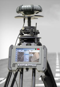
Skip to content

TAG: surveying

photo: Carlson

Carlson releases BRx6 GNSS receiver for surveyors

August 31, 2016

This article is tagged with , , , , and posted in Latest News, Survey
chart: Rowan County height differentiation

Establishing orthometric heights using GNSS — Part 8

August 3, 2016

Image: GPS World

Launchpad: OEM, UAV and survey/mapping products

August 1, 2016

Image: GPS World

3DR to integrate Site Scan with Esri Drone2Map

July 6, 2016

This article is tagged with , , , , , , , and posted in Latest News, UAV/UGV
Image: GPS World

Esri agreement to provide access to Chinese maps, imagery

July 5, 2016

This article is tagged with , , , , and posted in GIS News, GIS Software, Mapping, Technology
photo: Spectra Precision

Spectra Precision MobileMapper 50 combines smartphone design with GNSS capabilities

June 29, 2016

This article is tagged with , , , , and posted in Latest News, Mapping
Esri Survey123.

ArcGIS apps for the field launched at Esri UC

June 27, 2016

Image: GPS World

3DR to integrate Site Scan with Esri Drone2Map

June 27, 2016

This article is tagged with , , , , , , , and posted in Latest News, Mapping, UAV/UGV