Walmart launches UAV for deliveries in Utah
February 14, 2023
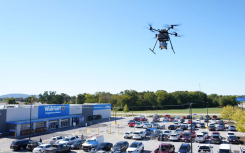
Two Walmart locations in Utah, one in Lindon and one in Herriman, are now providing UAV delivery for customers nearby.
Read More
Two Walmart locations in Utah, one in Lindon and one in Herriman, are now providing UAV delivery for customers nearby.
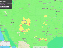
GPSJam.org has shown regular interference with GPS signals in Texas near San Antonio and Del Rio, and locations north and south of Oklahoma City, Oklahoma.
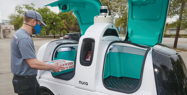
In April, the pizza company Domino’s and self-driving delivery company Nuro launched autonomous pizza delivery in Houston, Texas.
The National Geodetic Survey (NGS) has revised an important technical document on the modernized National Spatial Reference System […]

Whether you are on the helping end of a disaster aiding in rescue and recovery, or on the receiving end being aided, GIS is supercharging the rescue efforts.

DigitalGlobe released satellite imagery of Houston after Hurricane Harvey hit. Hurricane Harvey slammed into the Gulf Coast of […]
Aerial images from a drone are being evaluated as a method to survey seagrasses scarred by boat propellers. […]


Follow Us