Diving into UAV lidar surveys
March 29, 2021
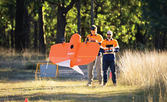
The worlds of UAVs, lidar and surveying overlap, with UAV-based lidar able to shed light on places that […]
Read More
The worlds of UAVs, lidar and surveying overlap, with UAV-based lidar able to shed light on places that […]

Teledyne Technologies will acquire FLIR Systems in a cash and stock transaction valued at $8 billion, both companies announced on […]
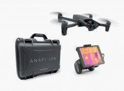
Skyward, a Verizon company, and Parrot, a European drone group, are partnering to deliver Parrot ANAFI drones along […]
Abom, a company that designs sophisticated commercial goggles, has launched new augmented reality (AR) goggles. Designed for safety, industrial […]

At least 65 people have been rescued by drones in the last year, according to a new report […]
SURVEY & MAPPING Mobile surveying app Increases RTCM 3.1 support SuperSurv’s NTRIP solution is being enhanced to adopt […]


Follow Us