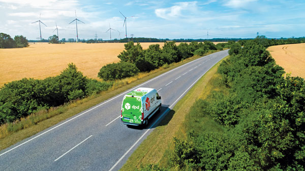
GPS technology helps communities across the globe
April 17, 2023
GPS Innovation Alliance (GPSIA) members improve the industries that feed, build, move and connect communities across the globe.
Read More
GPS Innovation Alliance (GPSIA) members improve the industries that feed, build, move and connect communities across the globe.
One way to implement direct georeferencing on UAV platforms is the Trimble APX-20 UAV, a GNSS-inertial OEM solution that increases the mapping efficiency of small UAVs.
AllTerra, a Trimble geospatial dealer, has joined the GeoCue distribution network, providing TrueView 3D imaging sensors.
Trimble has partnered with Nissan Motor Company to use Trimble’ RTX network as the positioning source to enhance the capabilities in Nissan vehicles.
Trimble’s new advanced path planning technology enables end users and equipment manufacturers to optimize and automate the trajectory, speed and path design of industrial equipment to increase efficiency.
The addition of scanning capabilities to robotic total stations enables surveyors to operate two instruments simultaneously, with the same field data collector and software.
Trimble has released the 4D Control (T4D) version 6.4 software, which is an add-on monitoring module for automated rail monitoring.
To reduce its emissions, DPD Deutschland — a franchise of DPDgroup, one of the largest international parcel carriers in Europe — has asked Trimble Maps to help optimize its operations.
Follow Us