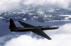
U.S. Air Force equips U-2 pilots with Garmin GPS watch
March 13, 2020
The U.S. Air Force is expected to take delivery of more than 100 D2 Charlie aviator watches for […]
Read More

The U.S. Air Force is expected to take delivery of more than 100 D2 Charlie aviator watches for […]

On April 2, a new museum exhibit will open that focuses on the U.S. Air Force’s role in […]

L3Harris Technologies has reached a major milestone in the U.S. Air Force’s Navigation Technology Satellite-3 (NTS-3) project — […]

Company modernize GPS for U.S. Navy and Air Force The U.S. Navy’s Naval Information Warfare Center (NIWC Pacific), […]

A proposed FAA rule — open for public comment until March 2 — would require drones over 0.55 […]

An accuracy test of the Locata Network — a non-GPS-based positioning system installed at the U.S. Air Force […]

On CBS’ Sunday Morning show Dec. 1, correspondent David Pogue was invited into the Air Force’s GPS Master […]

The Air Force seems to be on track to experiment with positioning, navigation and timing (PNT) satellites in […]
Follow Us