Data Mapper Offers Cloud-Based UAV Software for Imagery
October 4, 2014
Data Mapper, an enterprise aerial data software by PrecisionHawk, will expand its cloud-based platform to process data collected by […]
Read More

Data Mapper, an enterprise aerial data software by PrecisionHawk, will expand its cloud-based platform to process data collected by […]

The Consumer Electronics Association today announced the debut of the Unmanned Systems Marketplace at the 2015 International Consumer […]

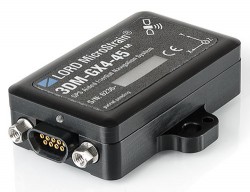
The 3DM-GX4-45 by LORD MicroStrain is a miniature, industrial-grade GPS-aided inertial navigation system that uses high-performance MEMS sensor technology. […]

A few weeks ago at the Esri 2014 International User conference in San Diego, California, we conducted our […]

Like it or not, as a person who works with geospatial data, UAS (unmanned aerial systems such as […]
Follow Us